| Manila and its districts. 1884. SHM By the end of the 19th century, most of the Manila districts had become consolidated, and many of them had acquired a personality of their own. | 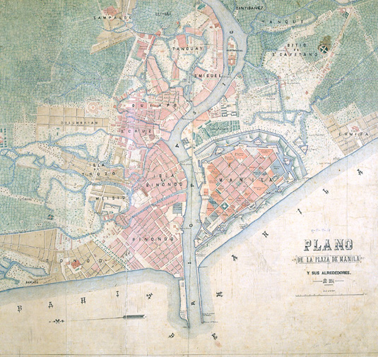 |
| The "Gran
Manila" |
| Manila and its districts. 1884. SHM By the end of the 19th century, most of the Manila districts had become consolidated, and many of them had acquired a personality of their own. | |
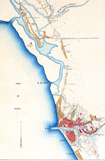 |
Plan of Manila included in the Manila - Tarlac itinerary. Juan Álvarez and Emilio Godínez. 19th century. SGE The abstract chessboard model adapted to difficult site conditions and followed the urban planning model adopted for Hispanic colonization. |
| Manila: its suburbs. 19th century. SHM In this 19th century plan, we can see just how much the city and its districts have grown. In the same area and during the 16th century, there were only two small towns: Manila, on the left bank of the Pasig River, and Tondo on the right bank. | 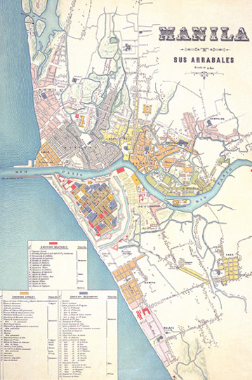 |
 |
The city of Manila and the villages beyond the walls in 1842. Antonio de la Yglesia. SHM The principal districts of Manila were Binondo, Tondo, Santa Cruz with the Bilibit prison, San Miguel on the banks of the Pasig, Quiapo and Sampaloc with their houses of cane and nipa palm. |
| Manila and its outlying villages. Mariano de Goicoechea. 1831. SHM The growth of the city beyond its walls was due on the one hand to a natural urban and demographic expansion, and on the other hand to the presence of the old rural churches around which new inhabitants were settled down. | 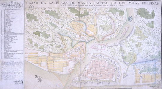 |
 |
The "Gran Manila". |
| Sketch of Manila and its suburbs. Emilio Godínez and Juan Álvarez Arenas. 19th century. SGE The systematization of this urban planning model was set down on paper in the Ordenanzas Generales de Descubrimiento y Nueva Población promulgated by Philip II, known also as the Indies Acts. | 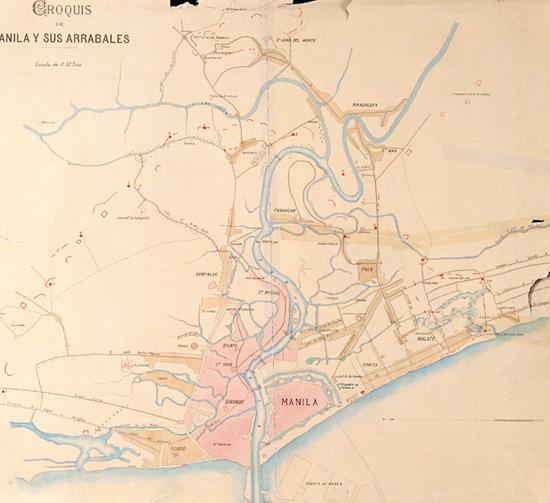 |
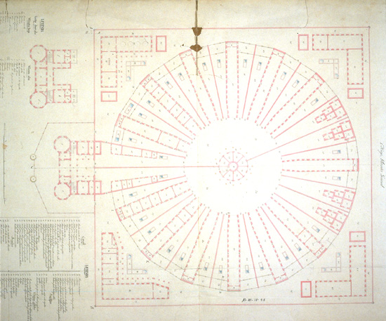 |
Project for a public prison. Emilio Díaz and Armando López Ezquerra. 1857. SHM |
| The Manila cemetery, located in the village of Paco. Ildefonso Aragón. 1823. AGI The Paco cemetery was built by the Town Council after the 1820 epidemic. This oval-shaped chapel topped with a dome was the burial place for captains general and prelates. | 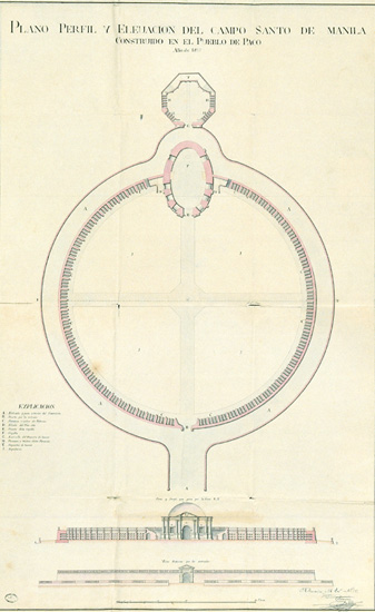 |
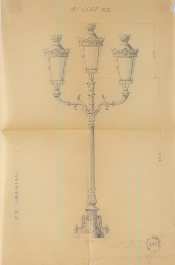 |
A triple-branched street lamp made by Lacarrière. 19th century. AHN José Echeverría, the engineer posted in Europe, was commissioned to supply the street lamps for illuminating the "Puente de España" over the Pasig River. |
| Project for the monument commemorating Magellan. Mid-19th century. AHN The monument commemorating Magellan was ordered to be built in 1848 by the governor, Clavería, at the top of the steps on the landing stage for passengers opposite the new Isabel II gate, which connected Intramuros with the esplanade and the "Puente de España". |  |
 |
Access to the Ordinary School for Schoolmistresses in Manila. BN In the early 19th century, when trading and city prosperity were at their height, a new mestizo stratum of society emerged, and this was to fight for its rights. |
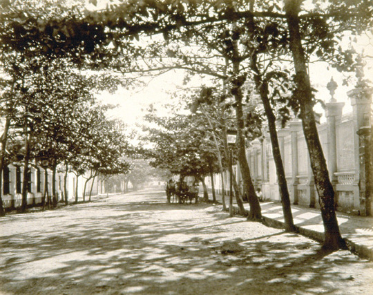
| Magallanes Avenue. SHM This popular avenue in Manila was the principal venue for society in the second half of the 19th century; here they combined leisure time activities with a visit to the nearby casino. | 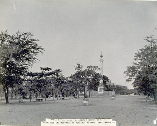 |
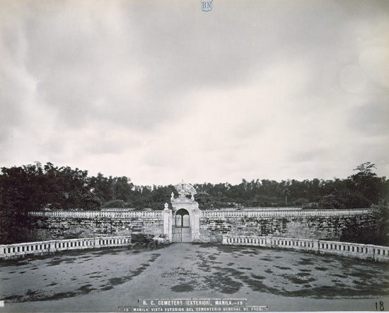 |
Exterior of the Paco cemetery. BN This cemetery was built as a general burial place for Catholics. |
| Ground plan, elevation and sectional view of the "Salón de Isabel II". F. Cortés. 1844. SHM This building, made from wood and thatched with palm over bamboo cane in the typical style of Philippine houses, was constructed on the Bagumbayan field to commemorate the coming-of-age of the Queen. | 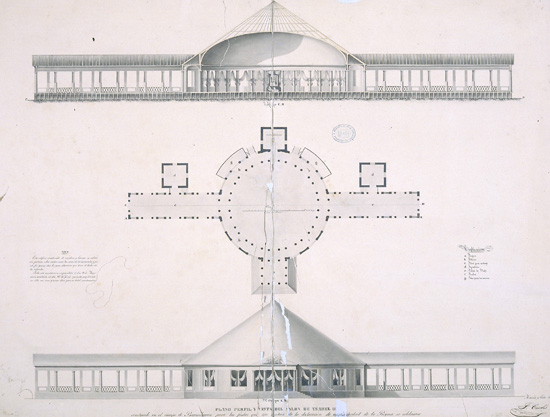 |
 |
Project for the construction of an avenue in Manila starting at the exit of the Parian gate ravelin. SGE After the 1868 revolution, an urban planning project was drawn up for Manila; this comprised the construction of fourteen roads on the south side of the river and thirteen others on the north side. Besides dividing up the city, these would also serve as firebreaks. |