The Philippines, an Asiatic archipelago


A country set in the heart of Asia, the Philippines formed part of the territories known in the West as the East Indies.

The Philippines, situated in the tropics and surrounded by the Pacific Ocean and the South China and Celebes Seas, comprises over seven thousand islands. The Philippines has suffered the devastating effects of earth tremors and earthquakes throughout the whole of its history: there are over fifty volcanoes on its territory. The Philippines, a melting pot of nations and different influences, has been the meeting point of numerous migrations. The Philippines started being colonized by foreign traders from the 10th century onwards: Moslems settled in the southern regions and the Chinese settled in Luzon. The Philippines, an area of low population density whose peoples practiced itinerant agriculture, was a country without cities; its urban development coincides with the arrival of Western culture in the 16th century. The Philippines began to widen its trading horizons after the arrival of the Spaniards, not only with countries in its immediate environs, but with many other far-off countries, by means of an extensive trading network that united all continents. The Philippines remained under the Spanish Crown until 1898, while many of its neighbour territories fell successively under the influence of different European powers: Portugal, France, Holland, Great Britain,...

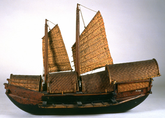
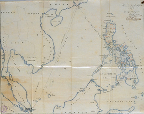
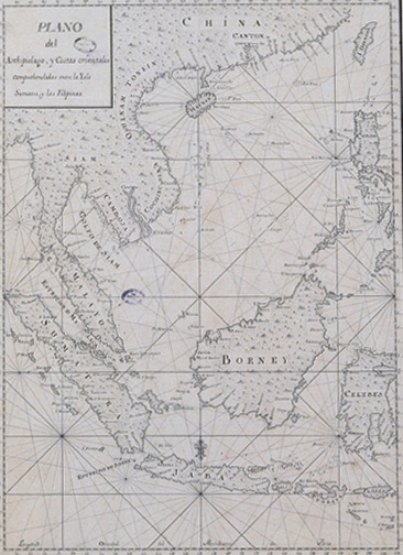
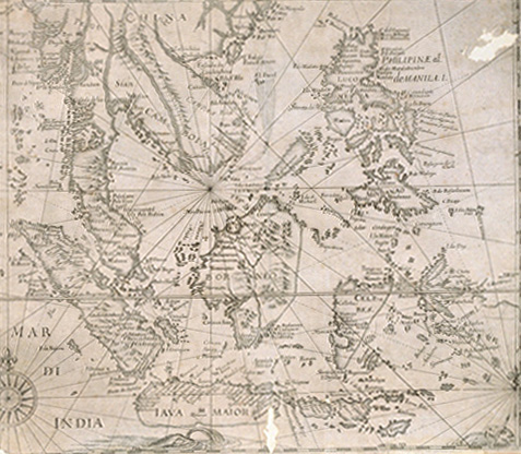
Model of a Philippine-built ship whose construction reflects western influences, and which was used for foreign trading. MN During the 19th century, indigenous trading continued along much the same lines as it had done from the 16th century. Beyond the immediate area of the archipelago, the greater part of trading operations were carried out with Borneo, China and Japan.
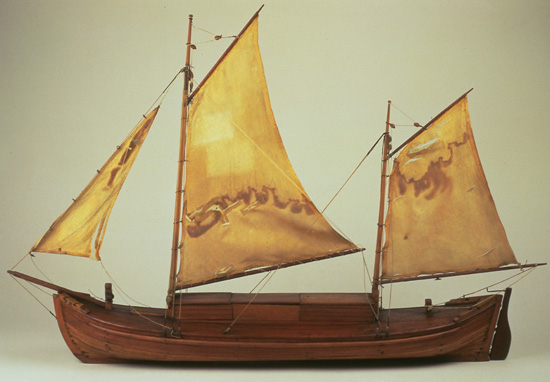

Model of a Philippine-built ship used for trading around the archipelago. MN Before the Spaniards arrived, the Philippines had a trading life of their own, and this was based on a system of bartering. The natives traditionally used the canals and river creeks to communicate with one another within a given area.


The island of Mindanao in the Philippines. Nicolás Norton Nicols. 1757. AGI At no time did the Spaniards ever gain complete control over the Philippine archipelago. When they reached Mindanao, they met with fierce resistance from its Moslem inhabitants.


General map of the Philippines. Pedro Murillo Velarde. SGE Trading activity involving oriental products between the Philippine colony and the mother country was organized around the Acapulco Galleon, which connected those islands with New Spain.


A Philippine Indian. Album fotográfico... End of the 19th century. BN The Philippine natives were a mixture of several races as a result of the succesive migration of peoples from the surrounding countries. The Japanese from the north, the Indonesians and Papuans from the south, Melanesians and Polynesians from the east and Chinese and Hindus from the west.


A mestizo Spanish woman. Album fotográfico de vistas y tipos de Filipinas. End of the 19th century. BN There were several types of Filipino mestizos: the Spanish mestizos who were the product of the union of Spaniards and Indians, and the sangley mestizos, who were the result of union between the Chinese and the Indians.


Spanish mestizo family. Album fotográfico... End of the 19th century. BN The population of the Philippines is extremely heterogeneous, and is the fruit of miscegenation with Europeans, Chinese and natives.


General map of the Philippine archipelago. 1865. AHN Spanish Manila maintained permanent trading contacts with China, Siam, the Malayan kingdoms and Japan. The Chinese traders brought silk, ready-prepared nails, iron sheeting, saltpetre, gunpowder, porcelain and silverware from Canton to this port.


General map of the China Sea showing part of the Philippine coasts and part of the islands of Indonesia. 1787. AGI From the 11th century onwards, the Chinese began to establish themselves over the whole of the Indonesian archipelago, besides founding trading settlements in the Moluccas and in the Philippines. When Europeans invaded the Orient these enclaves acquired a fresh significance.


General map of the Philippines, Indonesia and Insulindia. SGE Although the surrounding territories were successively occupied by other colonial powers, the Philippines remained firmly linked with Spanish America, and took no part in the trading rivalry occurring among these other powers.


Laguna and the Taal volcano, on the island of Luzon to the south of Manila. Circa 1860. SGE Volcanic activity was a determining factor in the orography of the archipelago. There are few islands that do not show any sign of this phenomenon which caused frequent earth tremors.


The Cagayan river in the north of the island of Luzon, in the Philippines. Juan Luis de Acosta. Circa 1720. AGI The valley of the Cagayan River, the largest and longest river of all those on the archipelago, was the great tobacco-growing region on Luzon.


The island of Mindanao with its fortresses and the territory occupied by the Jesuits and discalced cloistered Recoletos monastic order. 1683. AGI The Spanish presence on the island was limited to the building of a few fortresses such as those of Zamboanga and Iligan, and the founding of religous missions.