Defence and fortification


The Philippines were considered to be a key part of the defence system of the Spanish Crown in the New World. The fortified city of the Philippines was Manila.

Manila soon became a fortified city. It was fortified in accordance with the principles of the bastion system: straight stretches of wall - the curtain walls -, against which polygonal precincts protruded - the bastions.
The fortified system comprises several parts: the fronts facing the sea and the river, which were less elaborate and complex; and the three-sided land front with its corresponding bastions. The Santiago Castle was built at the sharpest angle, between the river and the bay, and this functioned as a citadel.
In the 18th century, the governor Gómez Pérez Dasmariñas gave great momentum to the fortification of Manila, his achievement being to surround the city with stone. From the 18th century onwards, the military engineers began to replace the governors in the construction of fortifications. In 1763, the English take the city of Manila.
Fresh projects are drawn up from then onwards: Juan Martín Cermeño, Feliciano Márquez, Dionisio O'Kelly and Tomás Sanz, are the engineers directing the works; although from the mid-18th century onwards the fortifications of Manila scarcely underwent any change at all.
In 1939, the Manila Intramuros precinct, one of the most important in the fortification system carried through by the Spaniards in the New World, remained intact.

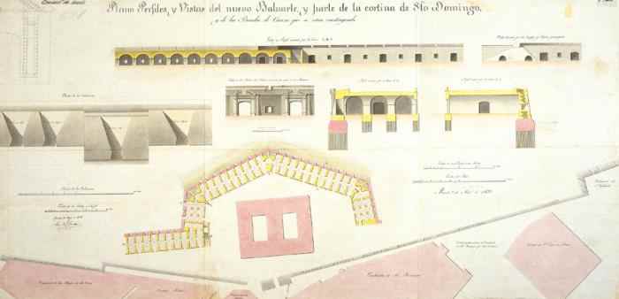
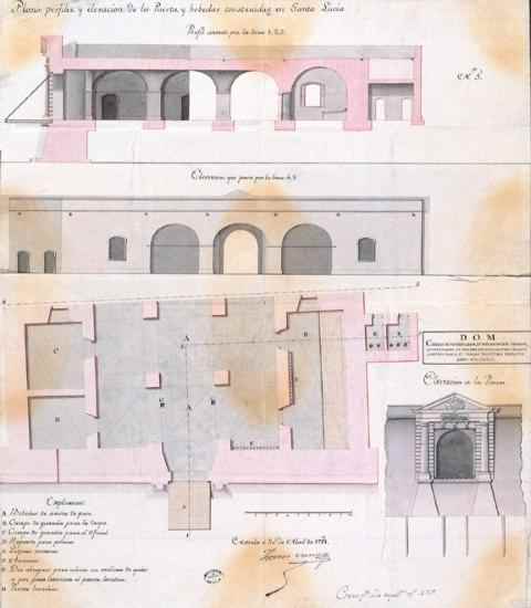
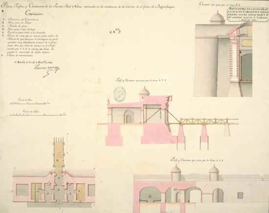
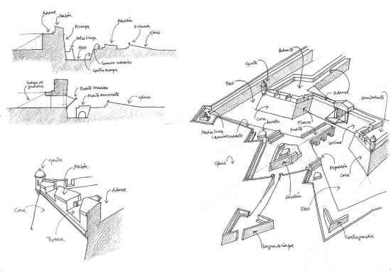
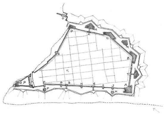
Plan and sectional view of the San Pedro redoubt. Tomás Sanz. 1781. AGI This was sited facing the sea, to the south of Intramuros. Its ground plan was square and it was constructed on the outer side of the city wall but access to the interior was provided by a narrow passageway.
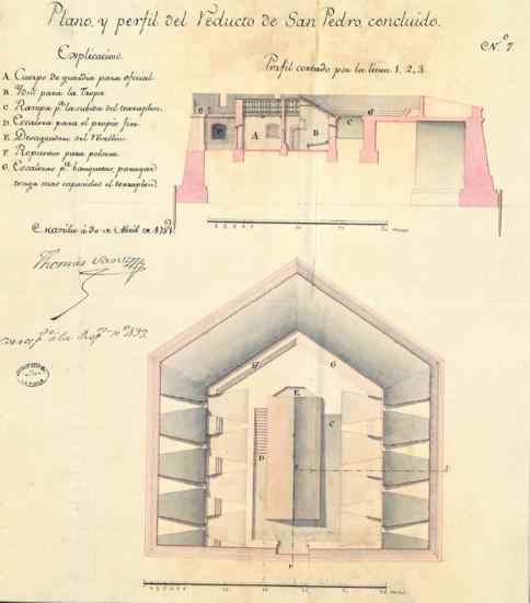

Plan of the ravelin sited on the Bagumbayan front. Dionisio Kelly. 1772. AGI This was an external construction covering and defending the curtain wall of a fort. This ravelin was built on the curtain wall of the Bagumbayan front in order to defend the "Puerta Real". puerta Real.


Plan, sectional views and front views of the new bastion and part of the Santo Domingo curtain wall. 1838. SHM This large bastion was constructed on the river front close to the Santo Domingo church and monastery.


Plan of the San Diego bastion and foundry. 19th century. SHM This fortification had a pentagonal shape: it protruded where two curtain walls met, two of its sides forming a sharp angle; it had two flanks joining it to the city wall, and one ogee as a point of entry. It was constructed on the site of the fort of Nuestra Señora de Guía.


Fortification of the city of Manila. Tomás Sanz. 1779. AGI The wall surrounding the Manila Intramuros precinct had four fronts: one facing the river, one facing the sea, and two land fronts, one of which was called Bagumbayan.


Plans, section view and front view of the house of the castellano at the Royal Fortress of Santiago. SHM The castellano was the governor of a castle.


Repair works undertaken on the house of the governor of the Fortress of Santiago. Manuel Wals. 1890. SHM Within the fort, Manrique de Lara ordered the construction of a semicircular platform called San José, which was situated in front of the Santa Bárbara bastion.


Plan of the Santiago castle or fortress. Dionisio Kelly. 1771. AGI Construction work was commenced in 1591 and was completed in 1634. This was the work of Leonardo Iturrino, and was the second most important fortress to be built of stone in Manila, the Nuestra Señora de Guía fortress being the first of these.


Plan of the Royal Fortress of Santiago, in the year 1824. SHM This was separated from the main "plaza" by a fosse flanked by two bastions: the San Miguel bastion, formerly known as San Gregorio, and the San Francisco bastion, formerly known as San Juan Crisostomo.


Plan of the city of Manila and the San Lázaro archipelago, with a new fortification project. Miguel Antonio Gómez. 19th century. AGI The most significant fortification projects undertaken for Manila were carried out during the 18th century, while the 19th century witnessed no works of any importance.


Plan, sectional view and elevation of the gate and archway of Santa Lucía. Tomás Sanz. 1781. AGI The Santa Lucía gate was one of the most important of those which gave access through the Manila city wall. It faced southwards towards the sea, and opened onto the María Cristina explanade.


Plan, sectional views and elevation of the "Puerta Nueva" which was constructed at the mid-point of the Bagumbayan curtain wall front. Tomás Sanz. 1781. SHM This gate was transferred in the 18th century to the centre of the curtain wall on the Bagumbayan front while still preserving its name.


Plan, sectional views and elevation of the Postern. Tomás Sanz. 1783. SHM The Postern gate in the city wall faced south on the seaboard curtain wall. In the 18th century, and as a result of the creation in Spain of the Corps of military engineers, new techniques were used to build the fortifications of Manila.